

Garmin Navionics+ Charts
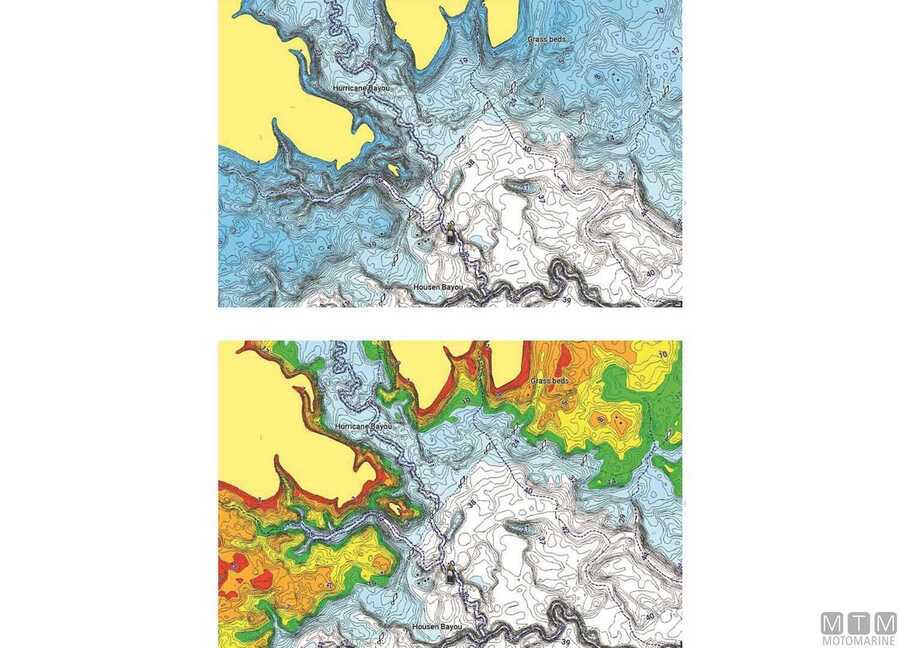
The Garmin Navionics+ cartography uses the world's n.1 technology to plot the route on Garmin chartplotter with bright colors, a simplified interface and complete contents to the smallest detail. Complete with Auto Guidance+ technology and updates via the ActiveCaptain app. Compatible with echoMAP UHD 7x/9x, ULTRA 102/122, GPSMAP 723/923/1223 and 8400 series.
| Product | Ref | Coverage | |||||||||||||
|---|---|---|---|---|---|---|---|---|---|---|---|---|---|---|---|
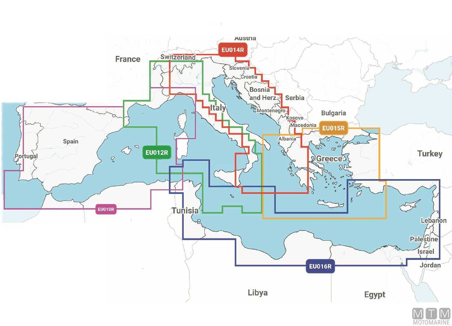
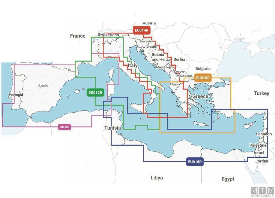
| NSEU010R | Spain and Mediterranean Coast | ||||||||||||||
|
|
|||||||||||||||
| NSEU012R | Italy West Coast | ||||||||||||||
|
|
|||||||||||||||
| NSEU014R | Italy Adriatic Coast | ||||||||||||||
|
|
|||||||||||||||
| NSEU015R | Aegean Sea and Sea of Marmara | ||||||||||||||
|
|
|||||||||||||||
| NSEU016R | South East Mediterranean | ||||||||||||||
|
|
|||||||||||||||
| NSEU643L | Mediterranean Sea, Black Sea and Iberian Peninsula | ||||||||||||||
|
|
|||||||||||||||
| NSEU646L | Central and Western Europe | ||||||||||||||
|
|
|||||||||||||||